Lebanon Emergency 2006
We are trying to use Google Earth placemarks on this page, if you haven't got Google Earth already then install it now - it's brilliant! The download site is: http://earth.google.com/
After you have installed Google Earth and you are online you can double click the placemarks on this page & it should take you there
We were both able to work in Lebanon on the emergency response to the Israeli bombing and occupation of the South, but unfortunately we didn't actually manage to meet up, we were working for different organisations and in different areas, and while Tony had the time available to travel he was working for the UN and under their security rules (more on that below) he couldn't travel to ime...
In fact, just before leaving the country Tony mannaged to get up to Baalbek, having had to travel everywhere in armoured cars while under UN security rules, as soon as the contract was over it was possible just to hire a taxi and drive up to meet with Carol, in complete safety of course!...
Tony was based in Tyre, the city in the South which has a long hstory of being beseiged - it was built on an island by the Phonecians and 3000 years ago was the most powerful city in the Mediterranean, the ships from here sailing to Cornwall to trade for tin and Phonecians sailed right round Africa on one occasion, the evidence being that they recorded the reversal of the relative position of the sun after they had crossed the equator. However, Alexander the Great besieged the city and built an enourmous causeway to the island so the siege engines could be used, and since then the causeway has silted up and the island has been a peninsular for the last 2300 or so years...
Google Earth placemark for Tyre
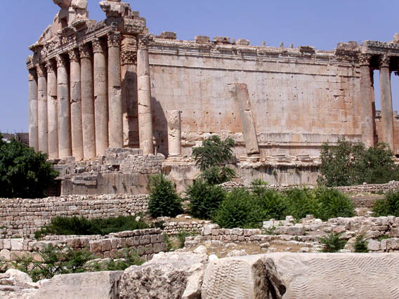
Carol was in Baalbek, the capital of the Bekka Valley, with spectacular ruins - the largest religious building in the Roman Empire.
Naturally both Tyre and Baalbek have been pretty heavily attacked, but along the border with Israel the damage is pretty astonishing; the Israeli Defence Force (IDF) brought in armoured bulldozers to try to completely remove all trace of some of the border villages, the fighting on the ground lasted the whole month of the war and the IDF then remained in the area setting up checkpoints at night and abducting people to use for future prisoner exchanges.
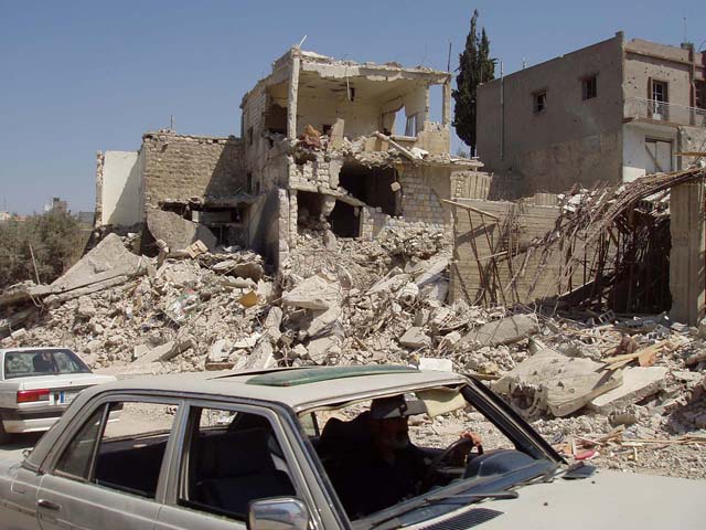
The damage in some towns was fairly extreme, and most astonishingly, the cluster bombing which has left so much of Southern Lebanon covered with what ammounts to minefields was almost all carried out on the last two nights of the war, and mainly against civilian areas such as Tibnine Hospital which was full of 1400 civillians sheltering in the hospital because they thought they would be safe there...
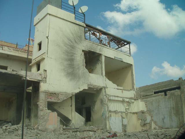
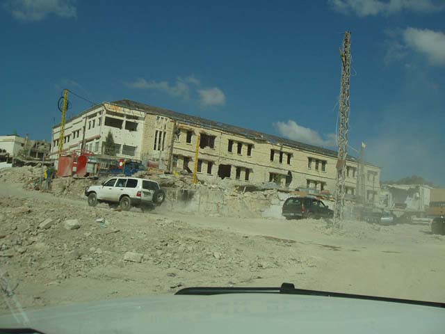
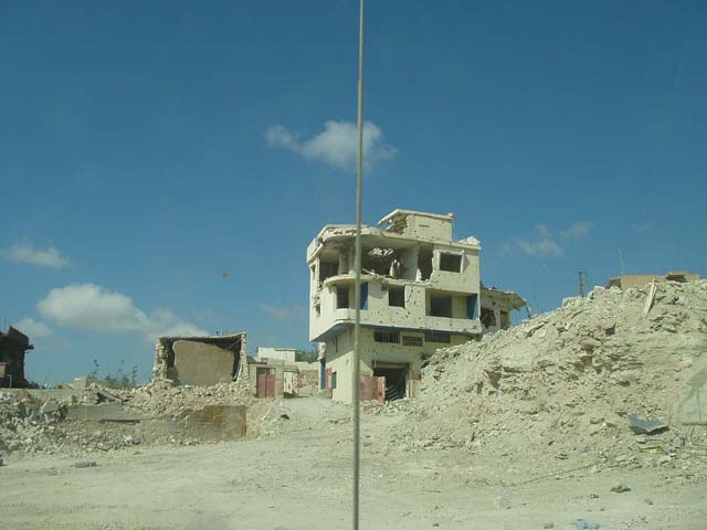
Ordinary towns were smashed with guided and unguided bombs, here are a few photos of Bent Jbail, it was a major town in the south...
Unfortunately most of these photos are not very high quality because I had to take them through the bullet-proof glass of an armoured car (Toyota LandCruisers with an extra 2 tonnes of armour plate & bullet-proof windows) because the UN security are concerned that the presence of cluster bombs everywhere means that we might drive over one and be hit by the shrapnel which is designed to kill anything unarmoured. (of course when we get out of the car we are allowed to walk round without armour, but that's just one of those paradoxes...)
And here's an example of a bomb which didn't go off. This particular UXO (UneXploded Ordnance) has now been cleared away after a month of lying in the street, but plenty more remain...

Here's a Link to Tony's trips around South Lebanon - it should take you to a Google Earth placemark which will show you the routes in blue. (if it works properly...)